|
Sea Level Rise in the Bay
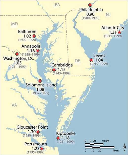
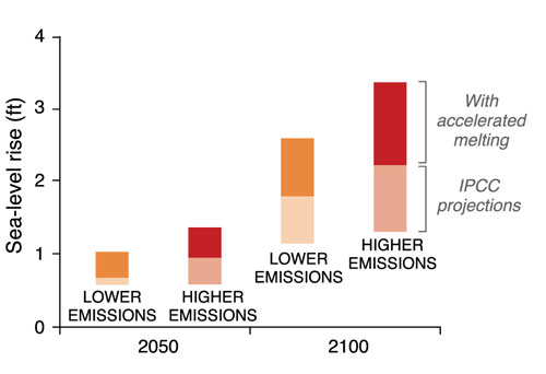
CLIMATE CHANGE AND SEA LEVEL RISE rive and exacerbate coastal hazards along Maryland's 3,000 miles of coastline. Shores are vulnerable to storm events and chronic hazards connected with erosion, storm surge, and inundation. In the last 100 years, Maryland's coastal waters have risen by more than one foot (see map above), reflecting a rate nearly twice the global average. This reflects the combined impacts of rising seas and regional land subsidence. The graph above shows projections for sea level rise, given a range of carbon dioxide (CO2) emissions. In the scenario with the greatest emissions, relative sea level rise along Maryland's coasts could top more than three feet by the end of the 21st century, according to projections by the Intergovernmental Panel on Climate Change.
|