Three people who live on the Bay's edge talk about the water rising around them. The videos are on Maryland Sea Grant's YouTube channel.
Videos: Residents Talk of Rising Waters
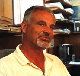
Watch “Holland Island Memories” on YouTube
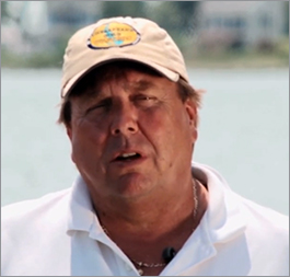
Watch “Hooper's Island Now” on YouTube
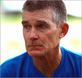
Watch “A Crisfield Flood” on YouTube
Photos: The Water's Steady Advance

Flood waters overtop a sea wall on Maryland's Smith Island in the Chesapeake Bay. Sea level rise is helping to make high water events like this one worse and more frequent on this fragile island. Credit: David Harp

Spartina grasses against the setting sun line a portion of the western edge of what's left of Holland Island on Maryland's Eastern Shore. Climate change, brought on by human activities, is causing sea levels to rise around the globe. Scientists estimate that on the Chesapeake Bay, the water level will climb by roughly 1.4 feet by 2050. Credit: David Harp

These houses on Virginia's Tangier Island sit just adjacent to acres of marsh grasses and, not far beyond, the open waters of the Chesapeake Bay. Low-lying island communities are especially vulnerable to sea level rise. Credit: David Harp

Sea level rise could reshape coastlines across the Bay, including along the narrow spit of land that makes up Hooper's Island in Maryland. The island loses about 24 acres each year to erosion. Credit: David Harp

High tides and storms often wash out roads in Hoopersville, one of the communities on Hooper's Island still above water most of the time. Only about 100 people live in Hoopersville today. Credit: David Harp

Sea level rise poses risks to urban areas, too, like the Ghent neighborhood of Norfolk, Virginia. These days, even routine high tides can leave portions of this low-lying historic district underwater. Credit: David Harp

This flooded street in Cambridge, Maryland, is appropriately named Water Street. It floods routinely during abnormally high tides from the adjacent Choptank River and the city is forced to close it to traffic Credit: David Harp

James Adkins, adjutant general of the Maryland Natural Guard, surveys a set of headstones on Maryland's Wroten Island. They are threatened by the encroaching waters of the Chesapeake Bay, which have submerged other graveyards on this island and other locations. Wroten Island, where Adkins' ancestors once lived, is now uninhabited. Credit: David Harp

In Dorchester County, Maryland, are many signs of sea level rise, like these tree snags in Bishops Head near the Blackwater National Wildlife Refuge. The trees were killed off by encroaching salt water. Credit: David Harp

To reduce erosion along Dorchester County's shoreline, the government should build up two nearby barrier islands, Barren and James, says Bruce Colson, who owns the Taylor's Island Family Campground. Sea level rise allows storms to push water further inland. Credit: David Harp

Maryland residents like John Barnette, a waterman and head of the Somerset County Swift Water Rescue Team, have seen the toll of sea level rise on their communities. Credit: Michael W. Fincham

When Superstorm Sandy hit Maryland in 2012, Barnette's team helped to rescue residents stranded by flooding in Crisfield, Maryland. Sea level rise will increase the height of storm surges on the Bay's shores. Credit: John Barnette

Harold Cartright, a resident of Hooper's Island, recorded the heights of flood waters that a series of big storms pushed onto his property. Here he points to a marker indicating Tropical Storm Isabel in 2003. Credit: David Harp

Homeowners in Saxis, Virginia, raise the foundation of their house to protect it from flooding. Many Bay residents have few options when it comes to dealing with sea level rise: build seawalls, elevate structures, or move away. Credit: David Harp

A bulldozer arranges sand in Ocean City, Maryland, as part of a long-running beach replenishment project there. Ocean City is one of many coastal towns that use sand dredged offshore to rebuild beaches that are steadily eroded by the ocean. Sea level rise will likely increase the rate of erosion. Credit: David Harp

U.S. Navy Captain Bob Clark looks out over Naval Station Norfolk, which he commands. This base, the largest naval facility in the world, is considering raising its piers so that rising waters do not disrupt its bustling operations. Credit: David Harp

Volunteers plant marsh grasses along a "living shoreline" on the South River in Anne Arundel County, Maryland. This native vegetation can protect shores from erosion and wave damage and create habitat for wildlife. Credit: David Harp

A little known fact about downtown Washington, D.C., is that significant portions could be severely flooded by the Potomac River, a threat worsened by sea level rise. Workers here test the lowering of a panel into a temporary flood wall that could be set up on 17th Street whenever a major flood threatens and removed when the threat subsides. Credit: Michael W. Fincham

This house on Holland Island in the Chesapeake Bay stood for more than a century. But the estuary's water level rose, the island eroded, and the inhabitants left. In 2010, the house — the last one left on the island — was swept into the Bay by encroaching waves. Other Bay islands have disappeared, too. Residents of the remaining inhabited ones, like Smith Island in Maryland, and Tangier Island in Virginia, are looking for ways to avoid the same fate. Credit: David Harp
Chesapeake Bay: Waters Rising
Places around the Bay where the water is rising, and the stories about them:
Will Your Neighborhood Flood?
Climate Central's Surging Seas map shows the land that rising water and storm surges put at risk, by town or zip code: open the map.
About the Opening Photo
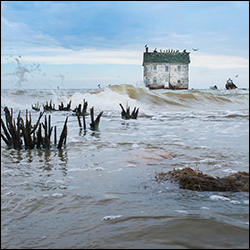
This was the last house on Holland Island in the Chesapeake Bay. It stood for more than a century, one of about 70 homes on the island, where some 360 people once lived. But as the estuary's water level rose, the island eroded, and by 1918 all of the inhabitants left. By early in the 21st century, only this house remained, surrounded by water at every high tide. Its last owner, the Rev. Stephen White, a Methodist minister, spent thousands of dollars from his own pocket trying to save the house by building up the shoreline around it with sandbags and other materials. But in October 2010, the house was swept into the Bay by encroaching waves.
Photographer David Harp took this shot in May 2009. He held his camera low to the water's surface to capture the effect shown. "I remember photographing there years before when there was a lawn there," he recalls. "I played softball on that lawn. There was ample space to play, not far from the house." Harp took the photo while standing in the same spot where he had played ball — except "I was in water up to my knees."
For more about the photographer, visit David Harp's website. For more about Holland Island, watch this Chesapeake Quarterly video.
