|
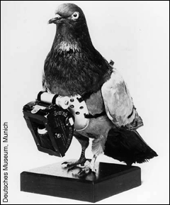
Today researchers have remarkable tools to produce a data-rich bird's eye view of the Chesapeake at multiple scales of resolution, but it has not always been that way. The idea of looking back at the Earth from the air is as old as photography itself. Since the 1840s, people have been trying to take pictures from above. In the years preceding the invention of the airplane, intrepid individuals used hot air balloons, kites and even pigeons to take aerial photographs. Once pilots were able to take to the skies in airplanes, aerial photography for military reconnaissance and topographical mapping quickly became routine. But it was the advent of space flight and the ability to put satellites in orbit that gave birth to the modern field of remote sensing and has allowed scientists to make quantitative measurements of the Earth's surface, its atmosphere and oceans.
Satellites quickly evolved to carry instruments that could monitor global weather, ozone depletion in the atmosphere, earthquakes and other geological activity, and ocean conditions. Nimbus 7, launched in 1978, carried the Coastal Zone Color Scanner (CZCS) that was the first instrument to scan the world's oceans to map chlorophyll concentrations in water. The project continued through 1986, when the Nimbus 7 satellite was deactivated, beginning a 10-year gap in the collection of satellite ocean color data. In 1996, the ADEOS-1 satellite was launched carrying the Ocean Color and Temperature Sensor (OCTS). This instrument enjoyed only a one-year career before malfunctioning.
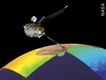
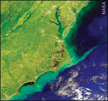
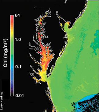
The launch of the SeaWiFS sensor on the Sea Star satellite on August 1, 1997 marked a major turning point for ocean remote sensing. SeaWiFS, a joint project between NASA and Orbital Sciences Corporation (OSC), has provided seven years of high quality data on chlorophyll abundance and primary productivity with the goal of examining oceanic factors that affect global change. Its coverage of the eastern seaboard, including a complete picture of the Chesapeake Bay every two days, has proven invaluable for scientists like UMCES researcher Larry Harding.
The Sea Star satellite and SeaWiFS sensor are tentatively scheduled to be deactivated in December 2004, but ocean remote sensing will not experience any break in service. Two new satellites are already in place, carrying instruments that also collect high quality ocean color data. Terra (launched in 1999) and Aqua (launched in 2002) as part of the Earth Observing System (EOS) carry the MODIS sensor, a state-of-the-art instrument that samples 36 spectral bands as compared to the 8 sampled by SeaWiFS. Together, Aqua and Terra provide daily morning and afternoon coverage of chlorophyll abundance in Chesapeake Bay.
Though many satellites are circling the earth, only a handful of them observe and monitor the marine environment. When NASA took a tally in 2000, of 8,681 satellites orbiting the earth only 2,465 were operational and the remaining 6,216 were classified as space junk. Fortunately, there are still orbital paths to spare and environmental satellites like SeaWiFS and others will continue to form the backbone of NASA's Mission to Planet Earth.
- Erica Goldman
|
![[Chesapeake Quarterly masthead]](/images/uploads/siteimages/imported/masthead.gif)


![[Maryland Sea Grant]](/images/uploads/siteimages/imported/h_footer_mdsg.gif)
![[NOAA]](/images/uploads/siteimages/imported/h_footer_noaa.gif)